Sun, Moon & Planets
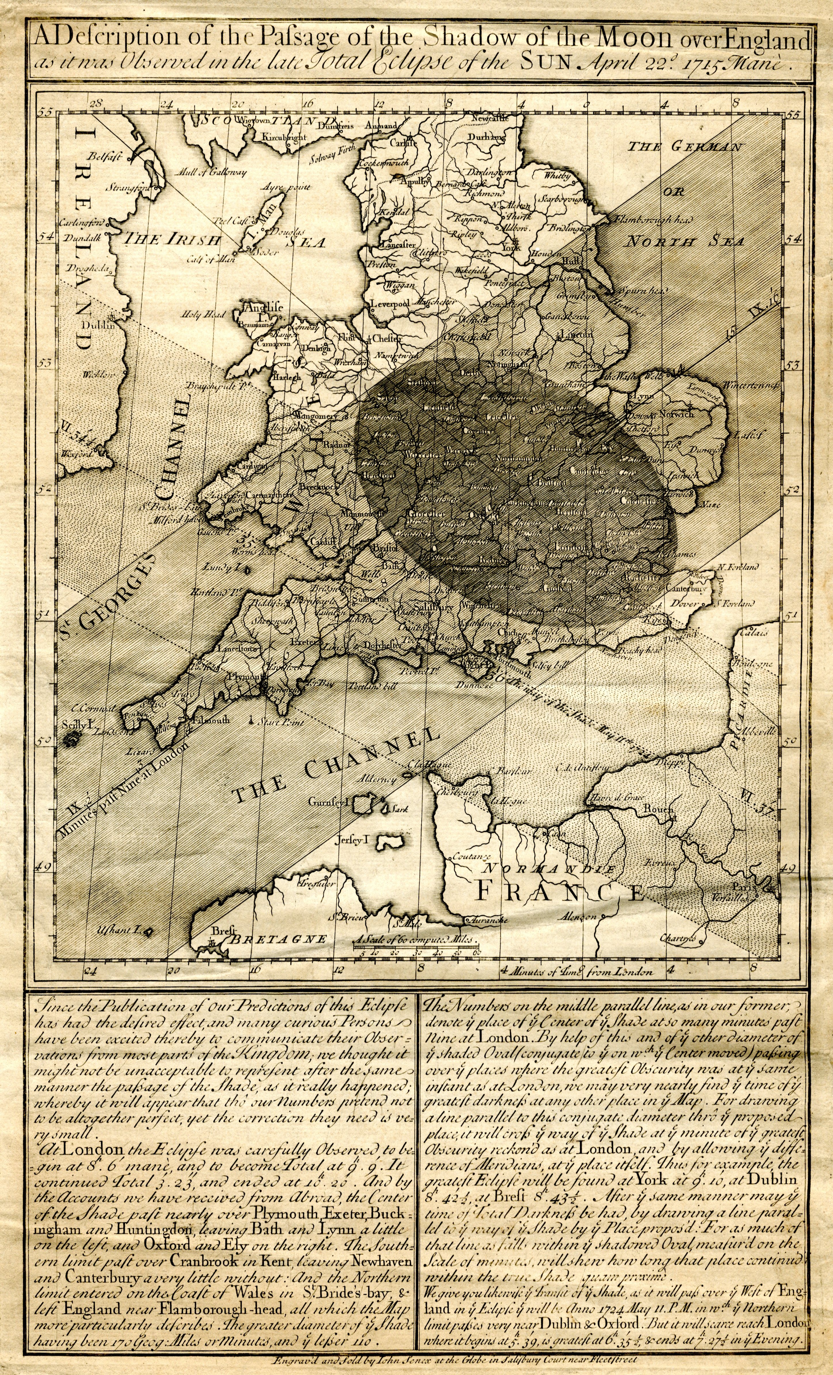
Halley's Eclipse Map of 1715
The first map to predict an eclipse's shadow across a nation.
- Chart
- A Description of the Passage of the Shadow of the Moon over England
- Astronomer
- Edmond Halley
- Date
- 1715
- Held by
- Published London · Wikimedia Commons
Finish
Format
The full-resolution scan, color-managed to the source — yours to print, study, and explore.
Size
$29.00
The story
In 1715 Edmond Halley — the comet's namesake — did something no one had done before: he printed a map predicting precisely where and when the Moon's shadow would fall across England during a total eclipse, sweeping a band of midday darkness from the west country to the sea. He asked the public to observe and report, making it an early act of citizen science. It was the founding document of predictive eclipse cartography: proof that the heavens ran on laws exact enough to foretell the very minute the daylight would fail. Wonder, made punctual.
See it on your wall
A window onto the heavens, in your home
Halley's Eclipse Map of 1715 printed large and framed, hung in rooms like yours. Every edition ships ready to become the piece the room is built around.




About this reproduction
- A faithful reproduction of a public-domain chart held by Published London · Wikimedia Commons — the work is centuries out of copyright.
- Printed to order on EMA matte art paper, 200gsm. Framed pieces sit in a box frame under acrylic, with no mount (gold-ink editions on specialist press).
- Color-managed to the source scan; we correct nothing and invent nothing.
- Ships in 5–10 business days, rolled in a heavy-wall tube (framed pieces ship flat-packed).
- If it arrives less than perfect, we reprint or refund — your choice.
Why our charts cost more than a poster: we print from the highest-resolution scans in existence, at sizes where the engraving itself becomes visible — the gold figures, the tiny stars, the cartouches — on a matte sheet that shows every line without glare.